Skip links
Reverse Engineering

Starting from an existing object

Reverse engineering services performed with state-of-the-art instrumentation

Reverse Engineering
03
Feedback
Our choices are always built on the response of clients.
5/5
9,78
Average rating from our clients.
3D Scanning

3D Scanning is a remote sensing procedure performed using 3D Laser Scanners.

Its scope of application can range from the environmental sector to the architectural and archaeological one. N-COM offers a complete 3D scanning and topographic survey service using 3D environment laser scanners, drones, photogrammetry software and the best electro-optical and GNSS topographic instruments available.

3D Scanning

3D Scanning is a remote sensing procedure performed using 3D Laser Scanners.

EN-COM offers a complete 3D scanning and topographic survey service using 3D environment laser scanners, drones, photogrammetry software and the best electro-optical and GNSS topographic instruments available.
We provide colour deliverables, in the form of point clouds, meshes or surfaces and complete our 3D services by converting point clouds to BIM models (Scan to BIM), implemented with information on the evolution of objects and their state of preservation, information relating to geometry, materials and construction techniques, historical period of the external walls and, if necessary, analysis of their static and dynamic functional integrity (through FEM structural analysis).
We have the best hardware and software tools on the market and years of experience in the sector.

The 3D scanning service using 3D environment Laser Scanners can be applied to carry out conservation engineering of historic buildings or to study whole archaeological areas or monuments.
It is also very useful in the mining sector. Through these surveys, in fact, it is possible to have a cadenced progress report of the excavation operations and calculation of the respective volumes extracted.
3D scanning also finds application in judicial issues, in road accidents or crime scenes.
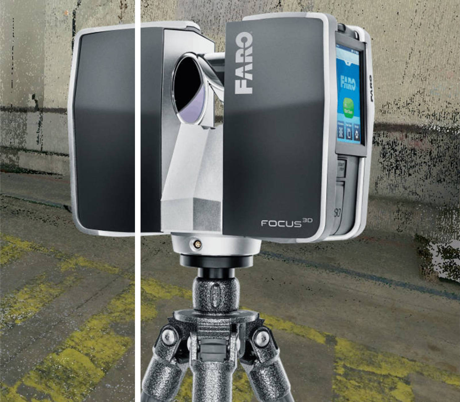
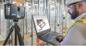
The 3D environment laser scanner is able to acquire the 3D geometry of entire buildings or large outdoor areas, through the 3D acquisition of point clouds.
The resulting 3D models can either be used as point clouds or they can be triangulated and converted into meshes or surfaces.
3D Laser Scanner surveys result in a series of point clouds which can be reconnected to the reference grids created by topographical survey, so as to achieve complete digitalisation of buildings or areas of interest in the correct geographical position, i.e. all digital 3D models obtained can be geo-referenced.
Point clouds can be enriched with orthophotos to achieve a realistic view of the scanned sites. With the 3D scanning service using environment laser scanners, it is also possible to request the elaboration of three-dimensional projects and two-dimensional project tables, or BIM models.

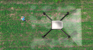
Architectural, archaeological and environmental surveys can be carried out by means of our photogrammetric survey service which can be performed using professional cameras (Reflex) mounted either on tripods or drones.
The digital photogrammetric survey aims to create contour lines, high-res geo-referenced orthophotos, thanks to the topographic survey, in a photorealistic way.
The result can be used for landscape, architectural, urban and cultural purposes, but also for metrically precise graphic purposes, for example, the façades of very tall buildings.

3D scanning of objects and body scanning

This process makes it possible to digitalise a physical object through 3D scanning and subsequent processing using CAD software.
Thanks to this process, it is possible to replicate or modify the object as well as create a new product that interfaces with it.
The phases that make up the digitalisation process are as follows:

The first step in reverse engineering consists in the 3D scanning of the object to be reproduced. Using a video projector, the object is hit by a sequence of codified light patterns while two cameras photograph it throughout the process. This procedure is called structured light scanning or more simply 3D scanning. Subsequently, special software performs triangulation of the points, i.e. it reconstructs their position and generates a triangle mesh of the object.

The second step is performed manually by an operator who, using CAD software, transforms the previously obtained triangle mesh into a quad mesh, optimising it for the following steps.

Once optimised, the mesh is re-examined, then any scanning errors are corrected and any modifications required are made using specific CAD software.

The last step in reverse engineering consists in extracting the mathematical information of the model obtained. This mathematical information is then used to generate the moulds which will be used to make the new object, as well as to perform structural, aerodynamic or other finite element analyses.

FOR EVERY NEED, ASK EN-COM
03
Services

do you need anything else? Let's talk about it!

We seek to connect with our customers beyond the traditional design and development agency relationship by becoming a development partner

To have an opinion on an existing project.

Tell us about your situation

+39 0524 688078

If you have an interesting idea but you don't know how to give it shape...

Propose it!

Send a message.

info@en.com.it

Explore
Drag